Return to Homepage


DIAGRAM OF PROPOSED SYSTEM

To study an area in more detail
select from the names below or
click on the map

Upper Weston

Hospitals

Lansdown (P+R)

Larkhall

Batheaston,

Bathford

Newbridge (P+R)

Western Riverside

 City Centre Circle

Churchill
Bridge

( Lambridge P+R?)

Bathampton

Twerton

Oldfield Park

Bear Flat

Bathwick

University
(P+R)

Whiteway

Southdown

Odd Down (P+R)

Combe Down

Click here for geographical map

Main system diagram 20 Kb

Routes Diagram

How were the routes planned?

Geographical map of system

Route lengths

What did the old tram map look like?

Catchment area served

Return to Routes and Services Homepage
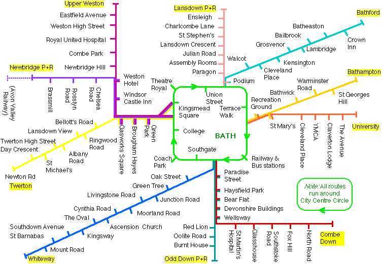

The system covers the majority of the built-up area of Bath.


The stops should be no greater than 500 metres apart. On this diagram the stops are named to correspond with their approximate location, but the exact details have not been finalised.

Click here to download this map for printing


Return to routes homepage